
PROJECT NEWS: A Smart Transit Hub Feasibility Study for Fort Smith, Arkansas
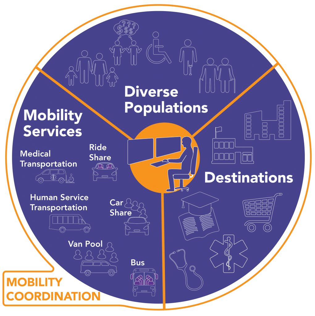
WTI recently completed a feasibility study for a “Smart” transit hub to serve an eight-county rural region in western Arkansas and eastern Oklahoma. The study presents a menu of technologies and programs that help connect people experiencing transportation barriers in rural communities to healthcare, employment, and higher education opportunities. WTI’s Small Urban, Rural and Tribal […]
STUDENT NEWS: Meet Alex Musar

Welcome to Alex Musar, who joins WTI this month as an Undergraduate Research Assistant for the summer. He will be working with David Kack, Andrea Hamre, and other WTI team members on a number of mobility projects, including the NADO technical assistance project in Southern Ohio and the MPO Travel Survey project in Montana. Originally […]
OUTREACH: WTI Director Updates Big Sky Chamber on $10 million Infrastructure Grant

In late April, the Big Sky (MT) Chamber of Commerce hosted a meeting focused on upcoming infrastructure projects in the region. WTI Director David Kack presented an update on the $10 million federal TIGER Grant, which will fund safety and mobility improvements along U.S. Highway 64/Lone Mountain Trail. WTI partnered with Gallatin County, Sanderson Stewart, […]
Animal Crossing: New Research Guides Efforts to Protect California’s Amphibians and Reptiles from Road Danger
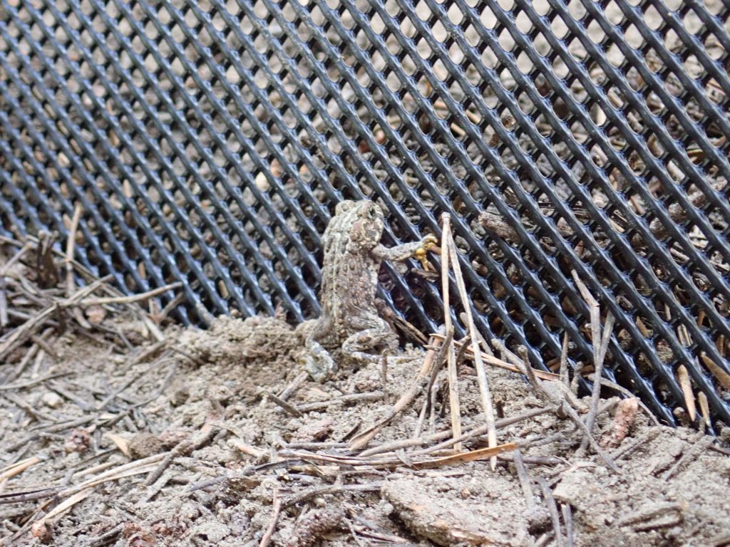
Companion video shows underground crossing structures in action Roads can be dangerous for California’s reptiles and amphibians, but a five-year study and new video show that there are effective strategies to help these animals cross roads safely. The California Department of Transportation (Caltrans) released the results of the study this week in a comprehensive, […]
Go Gallatin Challenge Kicks Off on May 10
Ready to move more in May? Join the Go Gallatin Challenge, which kicks off on Monday, May 10! It’s a two-week competition among organizations across the Gallatin Valley and surrounding areas to replace drive-alone trips to and from work by biking, walking, riding the bus, teleworking, and carpooling. Challenge participants that log at least 3 […]
NPS Introduces Fellows on Transformation Tuesday
As part of its “Transformation Tuesday” series, the National Park Service (NPS) profiled three fellows from the Public Lands Transportation Fellows (PLTF) program who are currently serving NPS units or projects. PLTF Fellows are assigned to a federal land unit for one to two years, where they lead or support projects that enhance transportation options […]
STUDENT NEWS: CATS Participants Create Designs for Bozeman Park
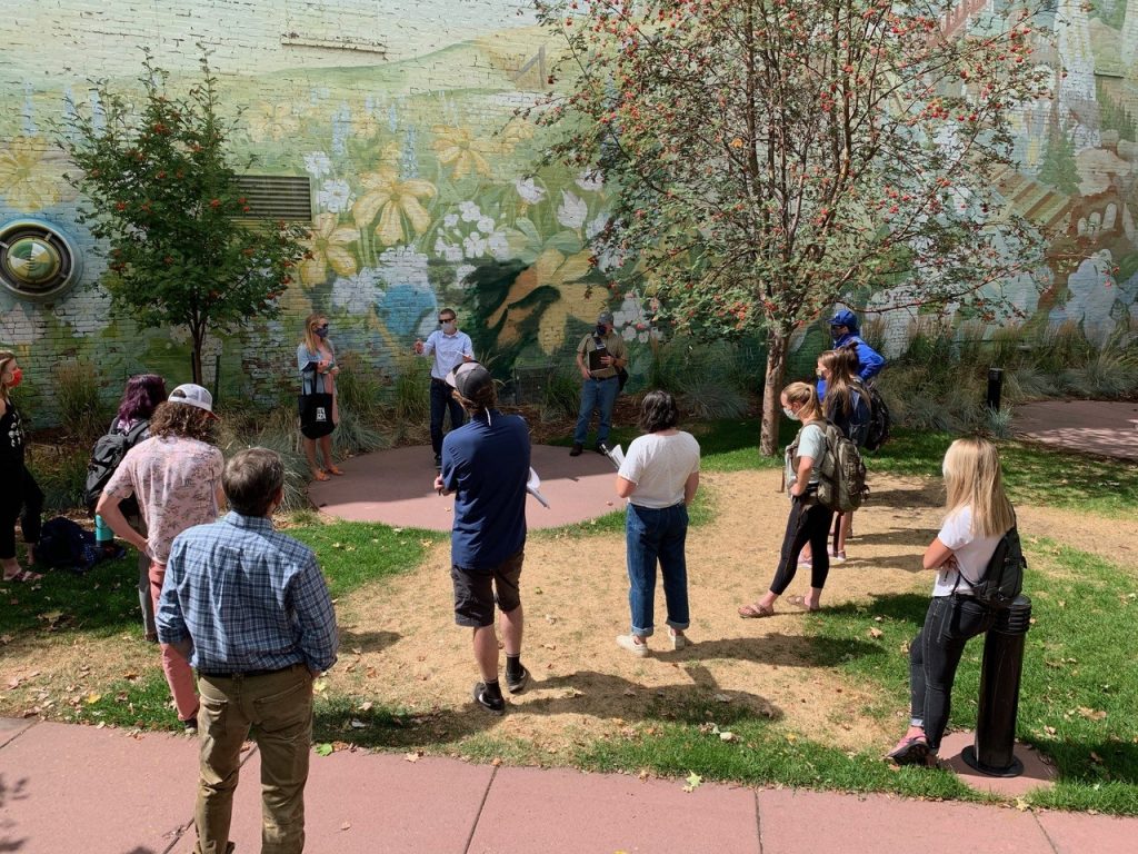
In a recent feature article, Montana State University News Service detailed the contributions of MSU students to future plans for Soroptimist Park in Bozeman, Montana. The students are part of the Community-Engaged and Transformational Scholarship (CATS) program, led by WTI, which matches projects identified and prioritized by Montana communities with students and faculty in relevant […]
PROJECT NEWS: Tools and Strategies for Developing Severity Indices
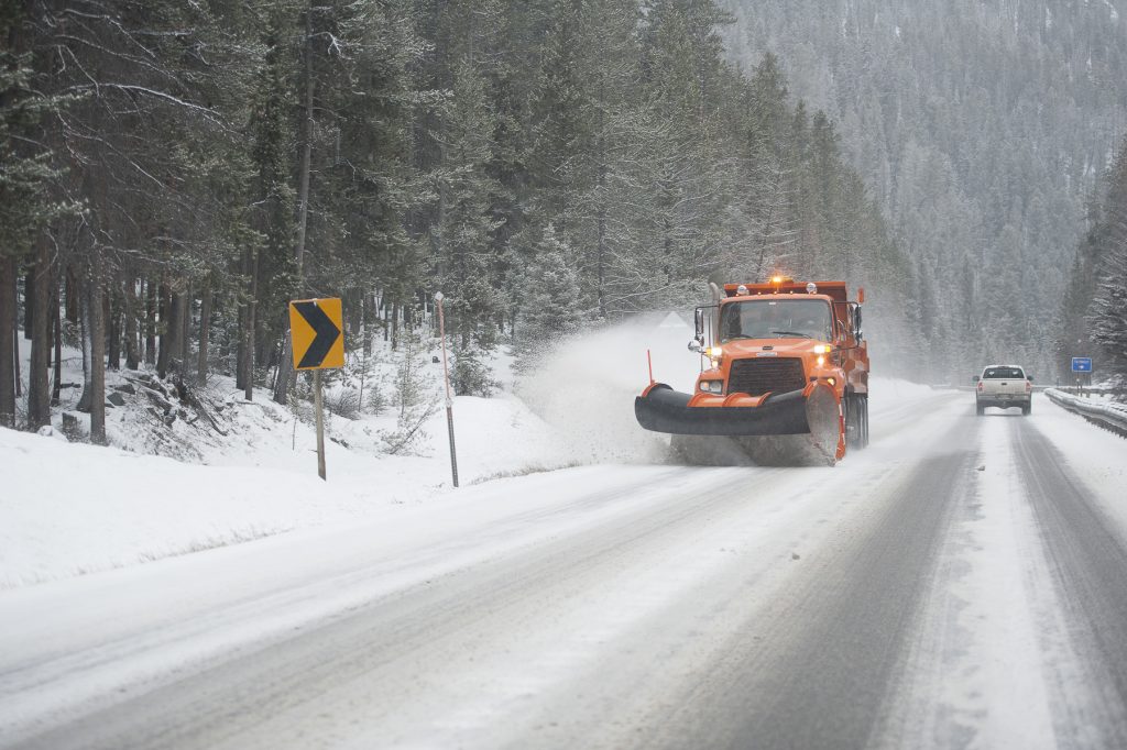
The Clear Roads research program, which sponsors practitioner-focused winter maintenance research, is highlighting a recently completed severity index project on its website. For “Evaluation of SSI and WSI Variables,” the Narwhal Group and WTI collaborated to create a step-by-step guide to support implementing a severity index, paired with a flowchart tool that helps match users […]
IN THE NEWS: Reducing Wildlife-Vehicle Collisions in Appalachia
Public Policy magazine In These Times recently interviewed WTI Road Ecologist Marcel Huijser for an in-depth article on wildlife crossings. “Toward a World Without Roadkill” highlights efforts by residents and local organizations near Great Smoky Mountains National Park to reduce the rising number of bears, deer, and elk being hit by vehicles on Interstate 40. […]