
>• Geography 358: GPS Mapping Service Learning
• City of Bozeman GIS Department
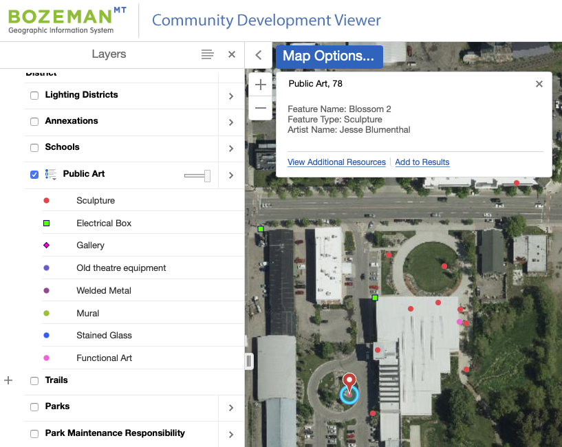
The City of Bozeman envisions a creative, learning culture through, among other things, support for public art. Working with City GIS staff, students in a senior level GIS course gathered the clean spatial data needed to add public art installations around town as a layer on the City’s public interactive mapping application, allowing members of the public to explore public art installation locations.
To view public art installations on Bozeman City’s Community Development Viewer, go to https://gisweb.bozeman.net/Html5Viewer/?viewer=planning
click on the Public Art Layer.