
MDT Announces WTI-led Project as Winner of AASHTO High Value Research
The Montana Department of Transportation (MDT) announced a research project they nominated, the “Effectiveness of Highway Safety Public Education at Montana Motor Vehicle Registration Stations by Streaming a Variety of Safety Content,” has been recognized by AASHTO RAC Region 4 as a 2024 High Value Research award winner in the supplemental category of Safety, Security, […]
WTI Well Represented at TRB 2024
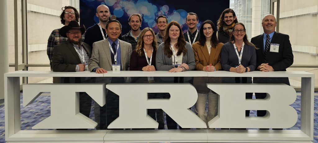
WTI Employees Continue to Make Headway as TRB Committee Chairs In the December 2022 issue of Newswire, we introduced you to three highly accomplished WTI researchers who chair TRB committees. We caught up with them after the 2024 TRB Annual Meeting for an update: Natalie Villwock-Witte has chaired the Standing Committee on Transportation Needs in National […]
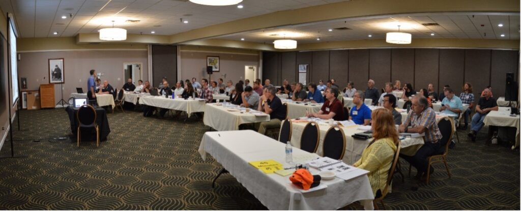
CALL FOR ABSTRACTS: Western States Rural Transportation Technology Implementers Forum
The Western States Rural Transportation Technology Implementers Forum is now seeking abstracts for the 19th Annual Forum, which will be held on June 18-20, 2024, in Yreka, California. If you are involved with a project you feel would be of interest to other technology practitioners, and would like give a presentation or demonstration, check out the Call For […]
End of an Era as COATS Project Draws to a Close
After twenty-five years and eight phases, the California Oregon Advanced Transportation Systems (COATS) project drew to a close this year, marking an end to an era. Sharing roots with the founding of WTI, the COATS project has made a lasting impact on rural transportation in the western states and beyond. The COATS initiative was established to […]
WTI’s Dr. Marcel Huijser Awarded Y2Y Funding for Grizzly Bear Research
WTI’s Dr. Marcel Huijser received funds from the Yellowstone to Yukon Conservation Initiative (Y2Y) to support continued grizzly bear research along US Hwy 93 North on the Flathead Indian Reservation in Montana. Conducted in collaboration with the Confederated Salish & Kootenai Tribes (CSKT) – known as the Séliš–Ql̓ispe in the Séliš language and K̓upawiȼq̓nuk or Ksanka in […]
International Transportation Pooled Fund Study Published: Findings Will Help Reduce Wildlife Collisions, Increase Habitat Connectivity, and Implement Cost Effective Solutions
Resources from a first-of-its-kind road ecology study are now available on the web through the Western Transportation Institute at Montana State University (MSU). The Wildlife Vehicle Collision (WVC) Reduction and Habitat Connectivity project, a Transportation Pooled Fund Study, was developed through an international partnership of fourteen state departments of transportation (DOTs), Canadian transportation agencies, and […]
PLT Fellow to Present NPS Transportation Research
Charlie Gould (B.A., History), a Public Lands Transportation Research Fellow (PLTF), will give his final presentation on innovative and emerging mobility technologies in National Parks on December 13th at 11:00 A.M. EST. The PLTF program assigns recent college graduates to a Federal Land Management Agency (FLMA) unit or field office with a known transportation issue. […]
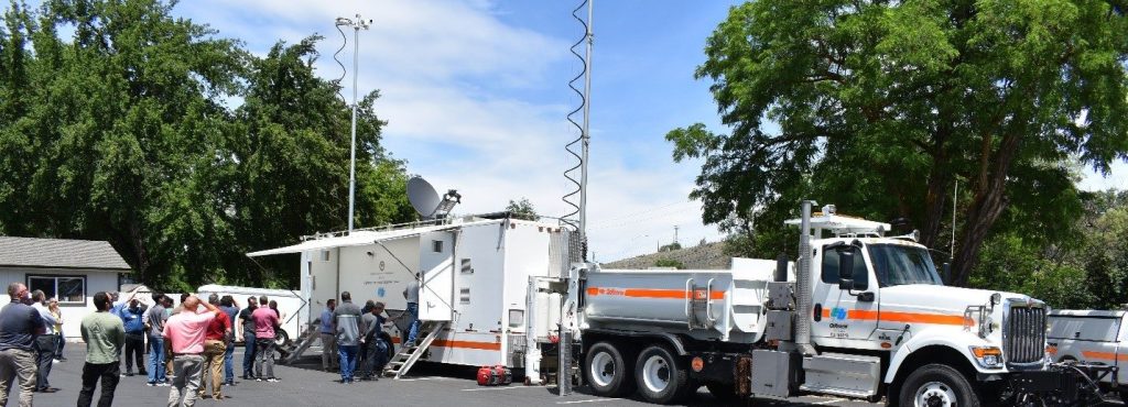
PROJECT NEWS: WTI Researchers Demystify the Salt Phase Diagram
Road salt, most often sodium chloride (NaCl) melts ice and is a crucial tool for winter maintenance crews around the world. However, the constant application of road salt is resulting in long-term environmental and economic impacts. To slow the negative effects of sodium chloride deicers by optimizing salt use, researchers from WTI and Washington State […]
PROJECT News: Scan of Communities with Fewer than 10,000 People finds Biking/Walking to be “Wheelie” Popular
Walking and bicycling have become increasingly popular transportation modes as people consider the positive impacts of active living. While there are examples of large, urban areas driving the implementation of infrastructure to support these modes within their jurisdictions, communities with populations smaller than 10,000 people may have limited infrastructure and know-how. Since 84% of communities […]
IN THE NEWS: Montana State University Highlights Two Decades of Wildlife Crossings Research
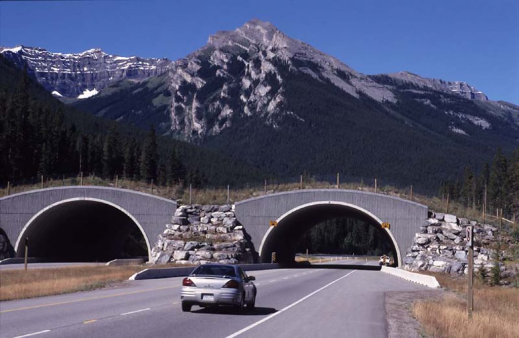
In a follow-up to last week’s New York Times article, Montana State University News published a feature article summarizing WTI’s long history of researching and advancing wildlife crossing structures. Starting with the first report to Congress on wildlife vehicle collisions in 2006, the article also highlights WTI’s long-term research on the effectiveness of wildlife crossing […]